Flying
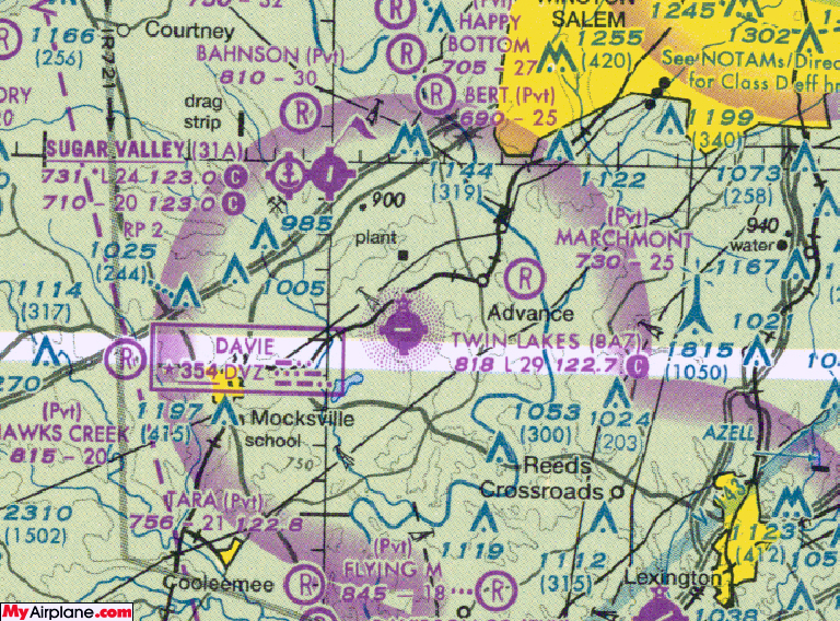
Twin Lakes Avionics is located at Twin Lakes Airport (8A7). We are 17 miles Southwest of Winston Salem (INT). Flying VFR you can spot the airport 3 miles South of RJ Reynolds tobacco sheds (30+ storage buildings) which can be seen for many miles. Local pilots prefer to land on 9 and take off on 27 due to the trees. Our Facility is in the Southeast corner of the airport.
Driving
(There are also Airport State signs along the way)
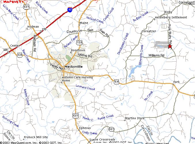
From Winston Salem take I-40 West to exit 180A (Hwy 801) turn right at the top of the exit go approximately 200 yards turn right at the McDonalds stop light on to Hwy 158. Go 2 miles, turn left onto Baltimore Rd. At the end of Baltimore Rd. T-stop, turn left onto Cornatzer Rd. Go 100 yards, turn right on Fork Bixby Rd. and the airport will be 2 miles down on the right.
From Statesville Take I-40 East to exit 170 (Hwy 601 – Mocksville). Turn right at the top of the exit and follow this road ( 12 miles) straight through Mocksville (do not turn at any of the lights, even though the map looks like there is a turn in the middle of Mocksville). The road (601) will merge with Hwy 64 and will continue through some country side about 7-8 miles, coming to the small town of Fork (a convince store on left, church on right, and fire dept, speed limit changes). Turn left (across from Fork Baptist Church) onto Fork Bixby Rd (turn before Rescue Squad). Go 2 miles and the airport will be on the left.
From Salisbury take Hwy 601 West to Hwy 801 North to Hwy 64 West, at the intersection of 801/64 (64 West is left off of 801 North). Turn Right onto Fork Bixby (1 mile from the 801/64 intersection), the airport will be 2 miles (from 64) on the left.